|
|
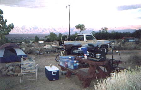
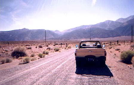
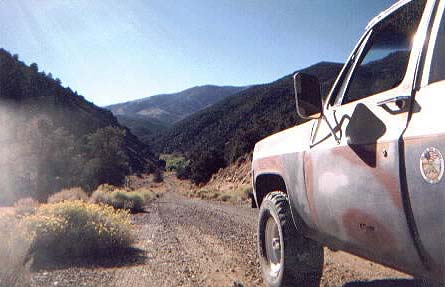
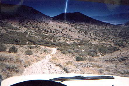
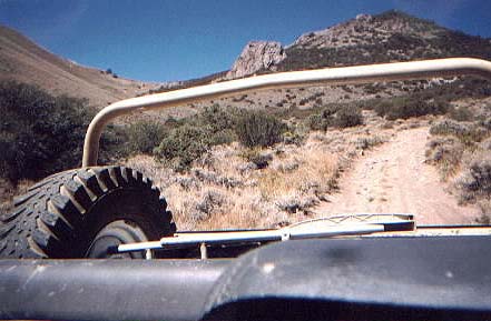
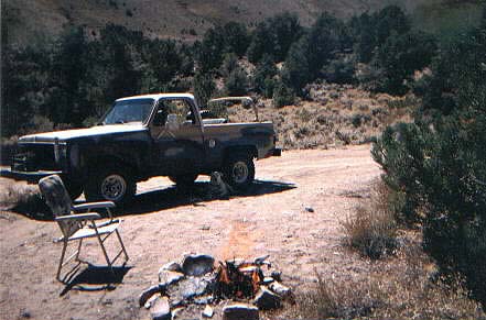
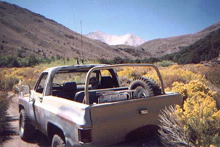
I've been on some of the local trails with a 4WD club and there was always something that bugged me. How come there isn't anything at the other end? And not much to see along the way either. Just pound the crap out of your truck and hope you make it to the other end? Well if you are like me and wish there was something along the way, here's the story of my 8 day vacation in the Owens Valley and Boundry Peak Wilderness. Nevada is only 45 miles away from the base camp. Some of the other trails I explored are within a few miles. Head up Hwy 395 to Bishop, Calif. Go about ten miles past there and you run into a nice little camp ground called Horton Creek Campground. It is a cozy little place set up against the foothills of the Sierras and overlooks the Owens Valley. You can stay there for up to 14 days for $5.00 per night. It was always free up untill 2005. There is a nice little creek and crappers. There are trees at most of the sites and a camp fire ring. This is where I set up my Base Camp. From here there are countless trails. Some within a few miles, and some up to 45 miles away. Across the valley you see the White Mountain Range. The north end of the range is capped with Boundry Peak which climbs to about 14'000 feet and is also the Nevada state line. The White Mountains also home to some mines and mining camps. Some diggings are actually still in opperation. There are spring fed streams here and there and even a small lake or two. And of course there are mule trails to all of these places. Some are huge well maintained 2WD dirt roads and some are classIII 4WD. In any case you need a 4WD to get to most as there are always bad places in dirt roads. For years I have been flying over the White Mountains in my Hang Glider and have been waiting for the time when I owned a 4WD so I could get to all the places I saw from hi above and do some exploring. Now that I have the K5 it's no problem! After flying over these places for all these years I can finally go visit them on the ground. And what a sight it was. It's even better then I thought. In Nevada, you can drive on wilderness land. You can have camp fires and you can carry guns. You can stay as long as you want and there are no permits or fees required. All they ask is that you don't leave trash and don't burn the place down. Simple as that. I took some photos of some of the things I saw. I also found out that it's going to take another 5 or 6 trips to take it all in and visit the other areas that I didn't have time for. I hope you enjoy the pictures I took. Unfortunately the dog was the only one with me for most of the trip so I couldn't get any action shots of wheeling for you. But you'll get the idea. This first set of pics are of my 8 1/2 hour trip over Queens Valley Pass which after clilmbing to about 9500 feet drops over the other side of the Whites. From there on out I found lots of beautiful views, a spring fed stream and lake with fish in it and of course mines and shacks. Coming out the other side leads to a great hot springs where you can also camp for as long as you want. (Bring the wife! She'll love it!) Click on any of the thumbnail pictures below to see a larger image of that picture. Use your BACK BUTTON to return to this page. |
 |
 |
 |
 |
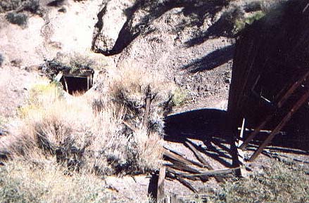
| Entrance to Queens Valley | Beginning Of The Trail | First Miners Shack | Another View From Above |
 |
 |
 |
 |
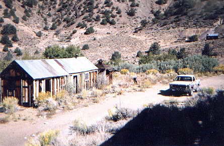
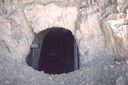
| Local Cafe & General Store | View Back Down Into Queen Valley | A Mine That I Didn't Want To Go Into | A Mine That I Did Go Into |
 |
 |
 |
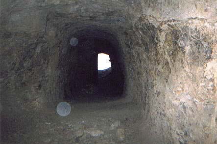 |
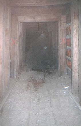
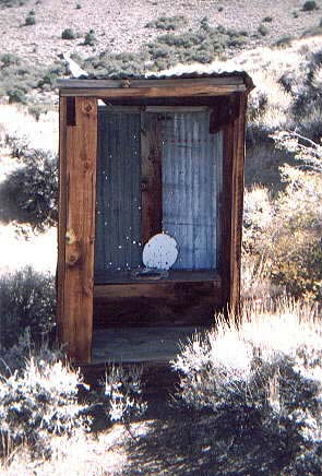
| Went As Far As The Cave In | The Local Crapper | Another Mine Entrance | Looking Out From The Inside |
 |
 |
 |
 |
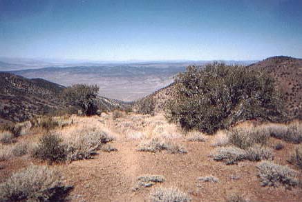
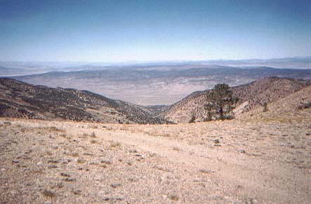
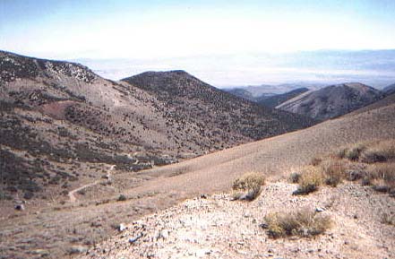
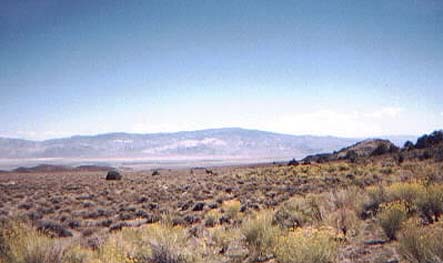
| Almost to the top, looking back on the trail | At The Top of the saddle, Looking Back from the Boundary Peak Trailhead | Looking Towards Fish Lake Nevada From The Top | Steep Soft Trail Leading Down Towards Fish Lake |
 |
 |
 |
 |
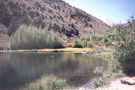
| Looking back from the bottom of the steep downhill run from the top. | Lunch Time! Hot Dogs and a coke. | Taking a Side Road Off The Trail | A Spring Fed Lake Along The Trail |
 |
 |
 |
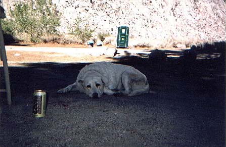 |
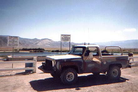
| Another View Of The Fish Filled Lake | Wild Horses In The Distance | The Hot Springs At The End Of The Trail | A Tired And Wet Big Dawg |
|
There are so many more things to see along the way that I didn't take pictures of. And pictures don't really do the place justice. You just have to go there and experience it for yourself. The air is clean and the sky is blue. The only people I met along the way was a family of local indians who were retreiving pine nuts from the trees. Coming out of the canyon on the east side of Boundry Peak there is another trail called Middle Trail that I will take a look at next trip. The whole experience was relaxing but it was tiring also. So I made the hour and 15 minute drive back to base camp in California to rest up for the following day's adventure. The rest of my vacation was filled with one trail after another. All were light to medium in difficulty, but there were some interesting obstacles involved with them all. 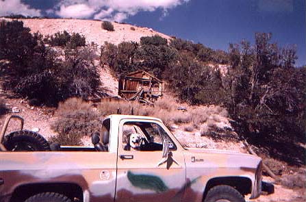 |